
Projects
BMEI is focused on landscape scale restoration “Ridge top to Valley Bottom”. The primary objective is to improve elk distribution on public lands as well as landscapes that have high tolerance for elk.
This objective is accomplished through active management which includes but not limited to; commercial and non-commercial forest thinning, prescribed burning, herbicide application, seeding, and road closures/reinforcement.
The following projects are actively being implemented and leverage BMEI funds in excess of 5:1.
Learn more about some current projects:
South Starkey Thinning for Elk Enhancement
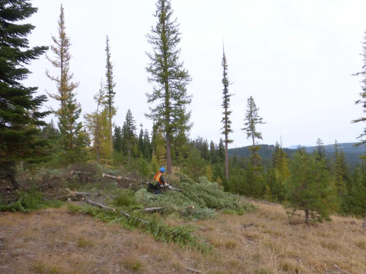
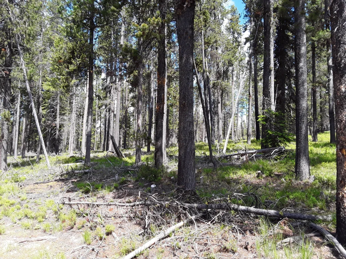
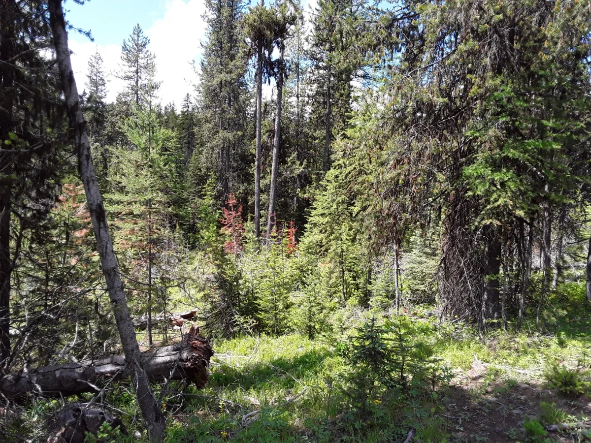
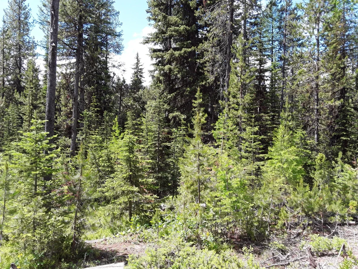
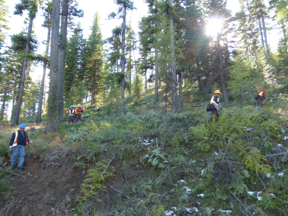
The South Starkey Thinning for Elk Enhancement 2022 (Project) is a continuation of a partnership that began in 2011 between the RMEF, the USFS, and ODFW. Since 2011, 6,958 acres in the vicinity have been thinned with the combined support of RMEF, BMEI, ODFW, Tittle II, Blue Mountain Habitat Restoration Council, and USFS funds.
The project area is within the ODFW Starkey Management Unit, adjacent to the Dry Beaver/Ladd Canyon Cooperative Travel Management Area (DBLC TMA) and combines two past RMEF funded project areas (Chicken Hill Thinning for Elk Enhancement 2011 - 2014 and South Starkey Thinning for Elk Enhancement 2015 - 2022).
The Project will create a more resilient landscape, increase the quantity and quality of forage for Rocky Mountain Elk in a large, contiguous area of high elk security (i.e., DBLC TMA), and reduce big-game damage on private land by reducing the density of young, mixed conifer stands.
Greater Williams Prairie Restoration Project
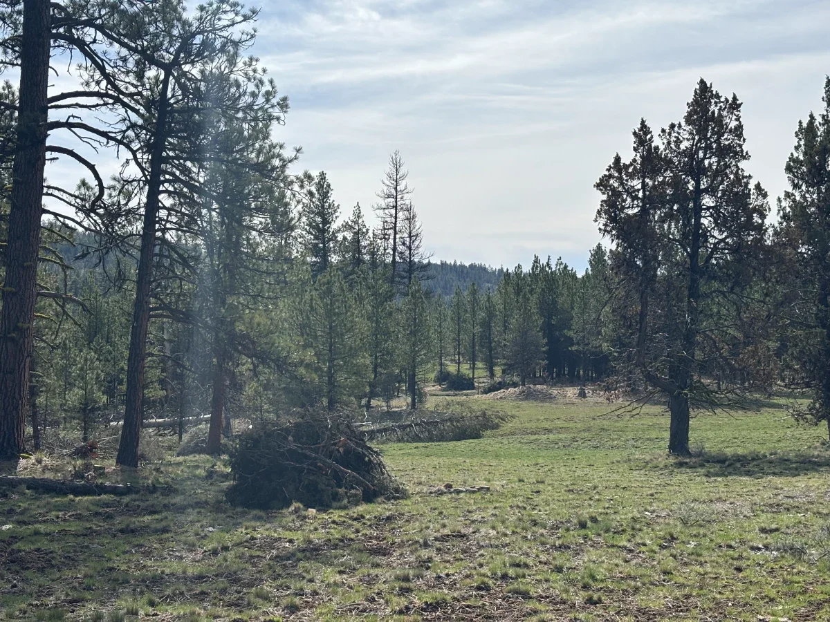
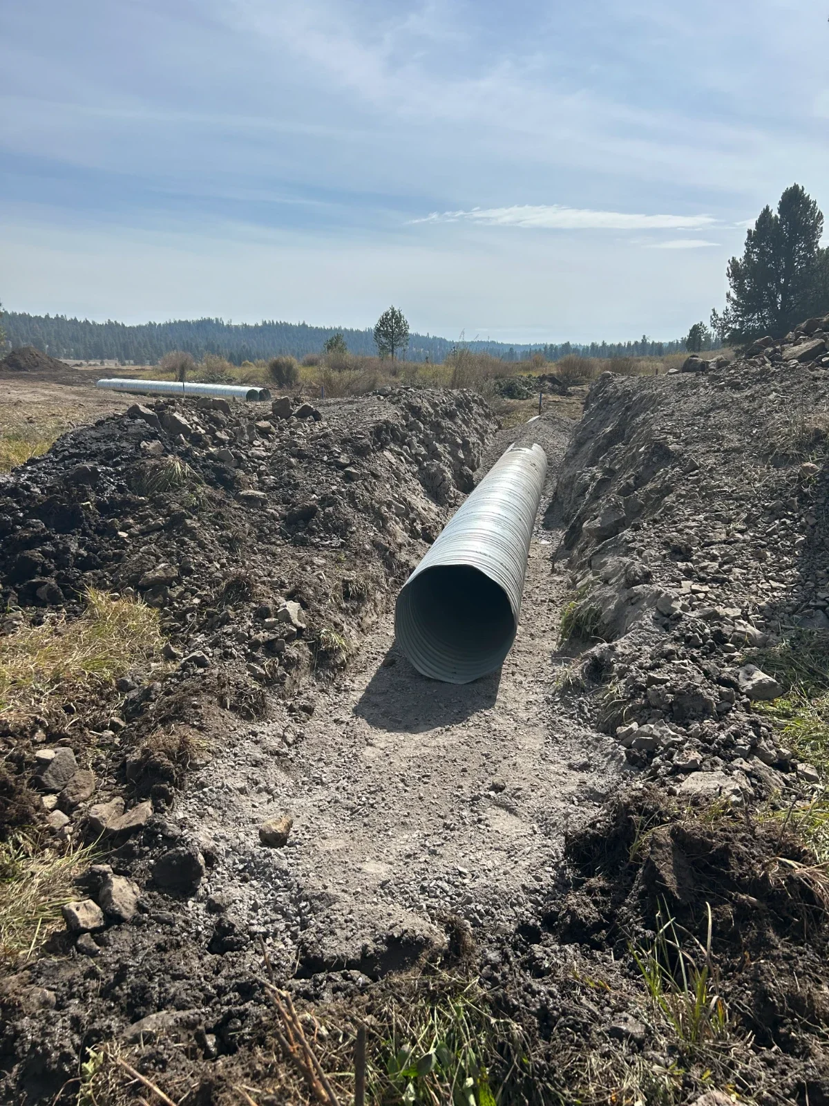
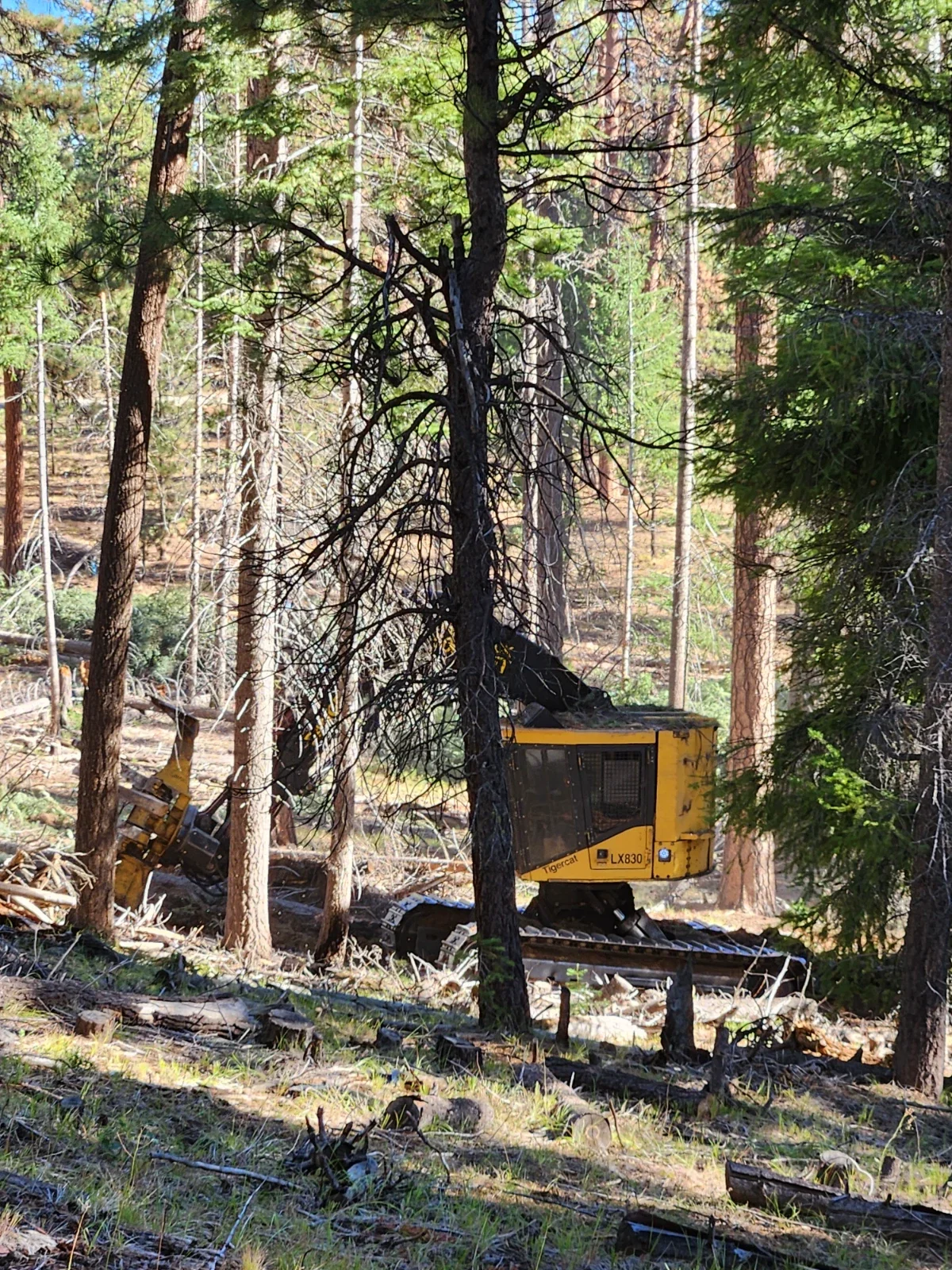
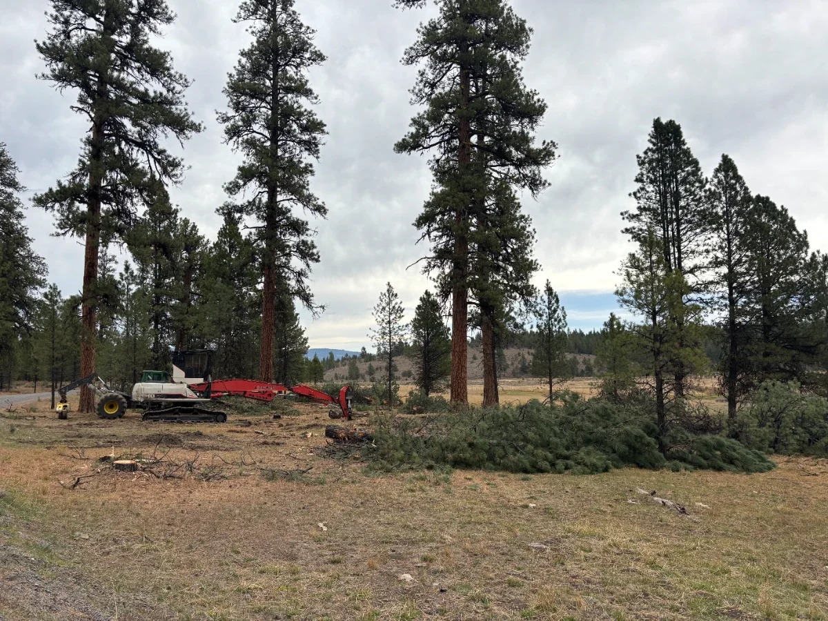
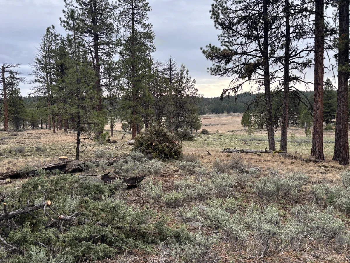
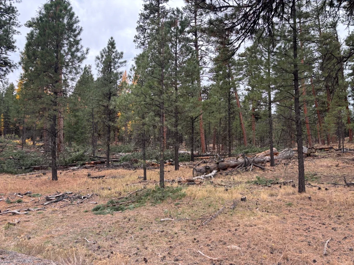
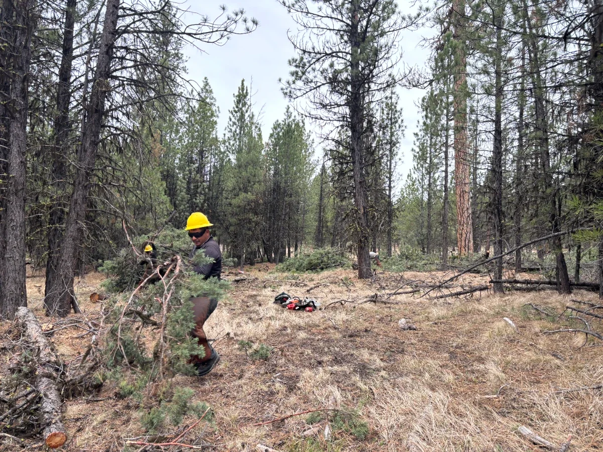
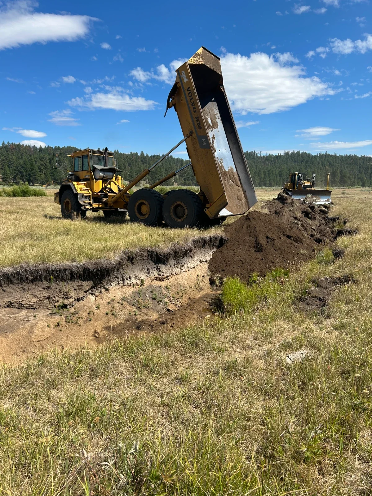
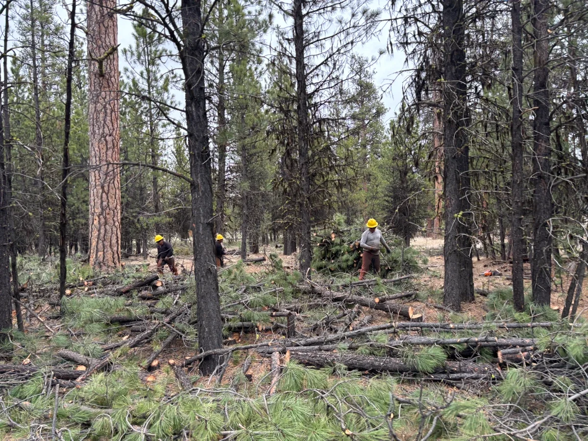
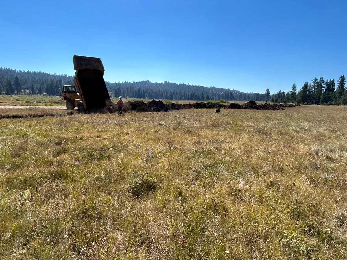
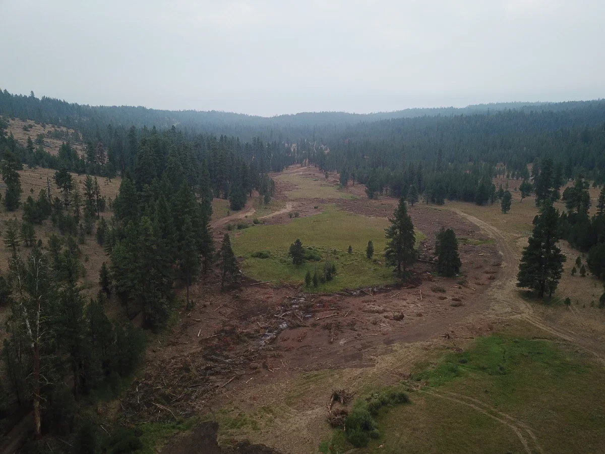
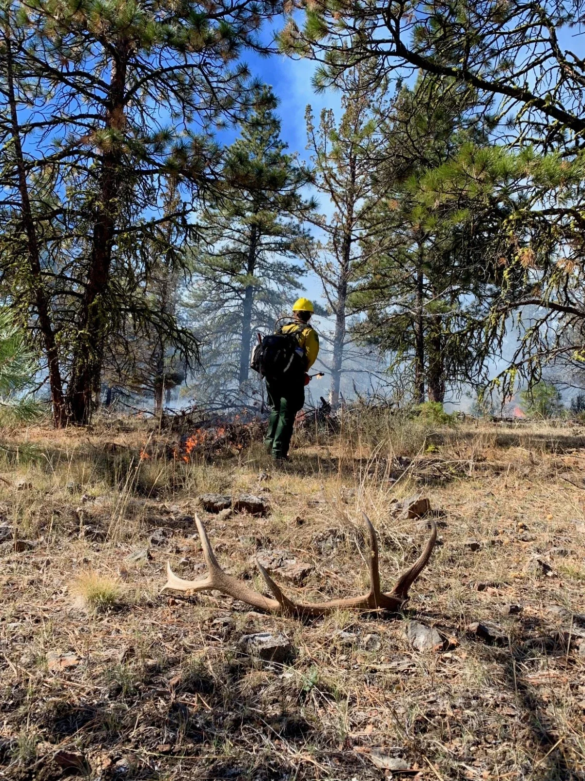
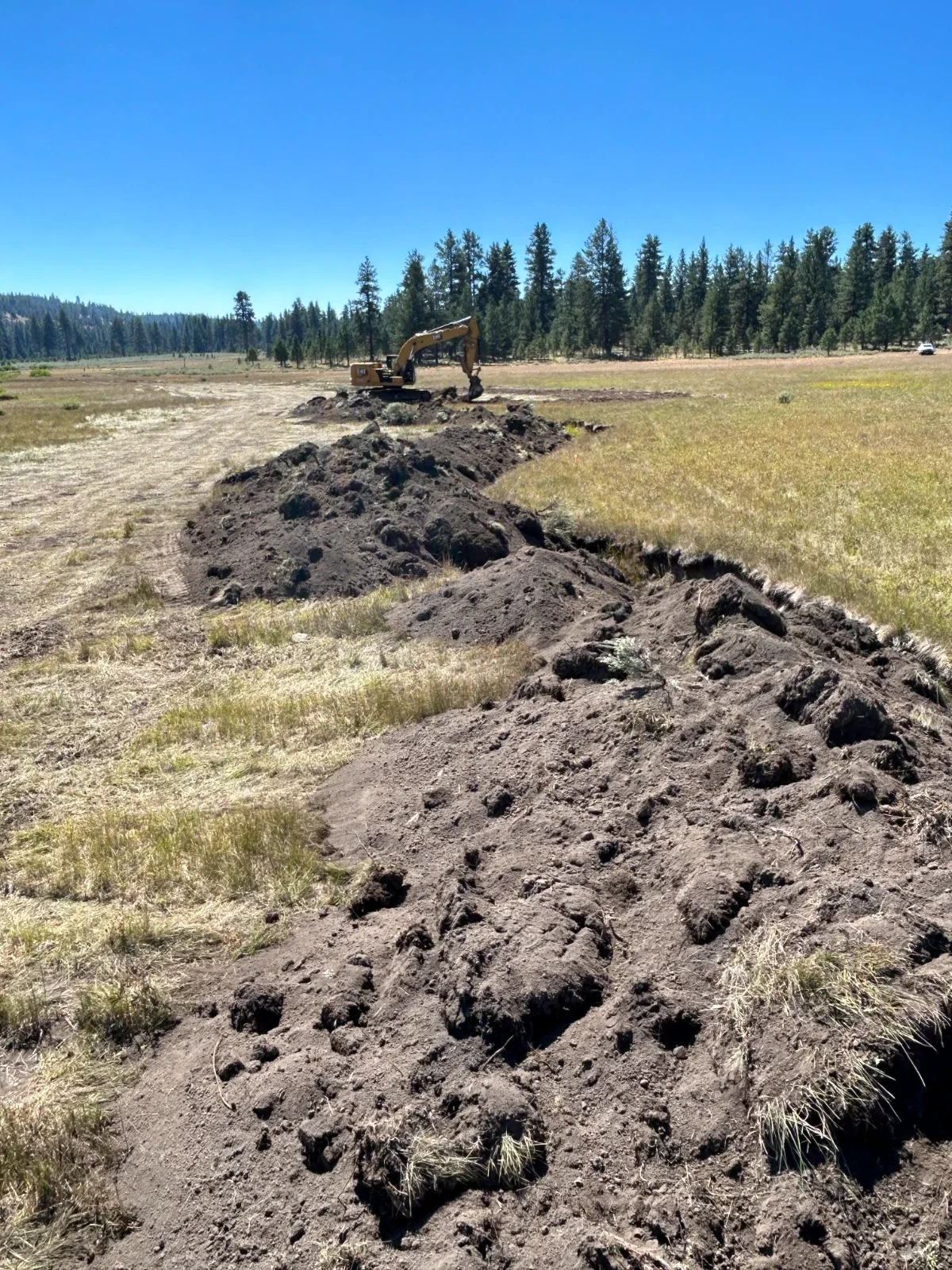
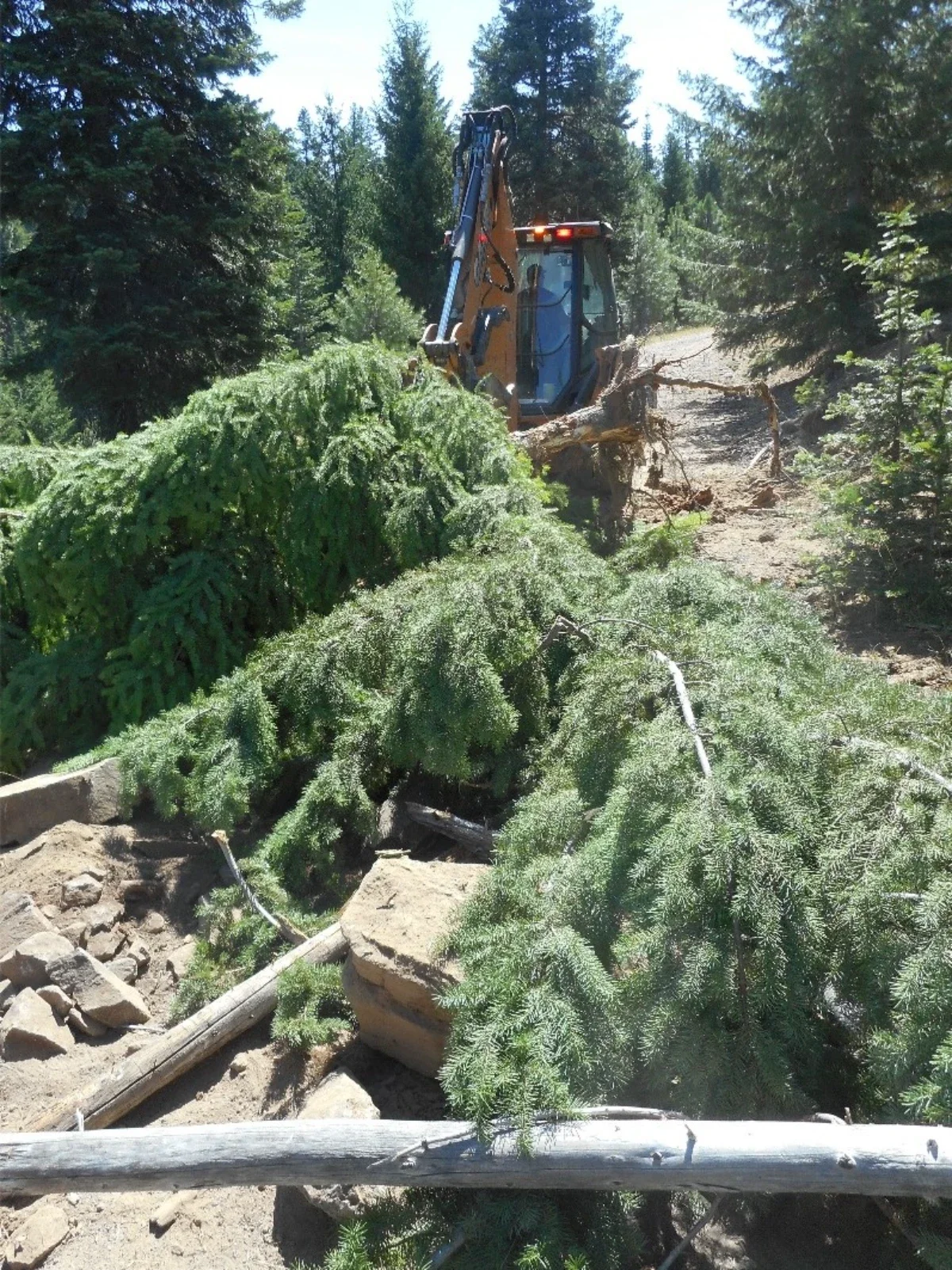
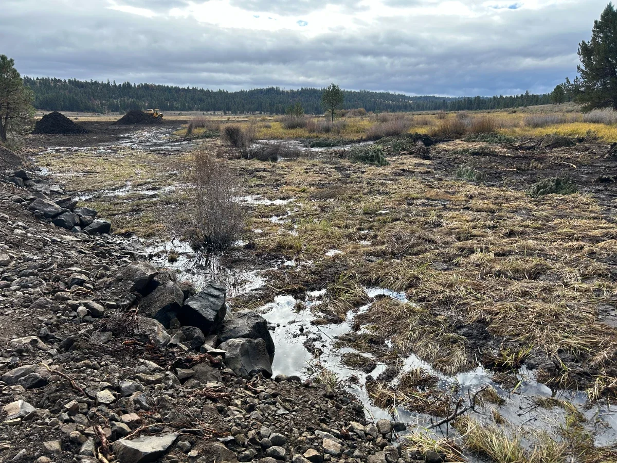
Ridgetop to Valley Bottom ‘Whole-Watershed’ Restoration (~17,500 Acres)
The objective of this project is to retain elk distribution on the Ochoco National Forest and to minimize impacts to adjacent private lands, specifically on Big Summit Prairie and the Nature Conservancy. Efforts coincide with other habitat restoration implementation in the Gap planning area.
Thinning efforts will create more forage for big game as a result of less competition for resources and an increase in sunlight reaching the forest floor. The project intends to improve the habitat effectiveness of elk and mule deer as well as other species which utilize late seral habitats through thinning and road closures and meadow restoration used for parturition habitat and critical forage for big game.
Restoration efforts will occur in habitats occupied by R6 sensitive species such as silver bordered fritillary, western bumblebee, Peck’s mariposa lily, redband trout, and Columbia spotted frog.
Meadow Restoration on approximately 560 and 68 acres of meadow/water table restoration at Williams Prairie and Lookout Prairie, respectively.
Aquatic flora and fauna habitat restoration on approximately 9.25 stream miles. In addition, all 8 miles of stream are projected to have large wood added.
Forest Health and terrestrial habitat restoration of up to 10,000 acres from ridge top to valley bottom (i.e commercial thinning of approximately 450 acres, non-commercial thinning of approximately 5,430 acres, mechanized slash treatment and hand-piling of approximately 1,100 acres, thinning around encroached aspen stands of approximately 11 acres). Additional stand-alone work planned in RHCAs includes approximately 38 acres of noncommercial thinning, 32 acres of hardwood restoration thinning and 202 acres of prescribed fire.
Approximately 30 miles of road treatments including 15 miles of road closure reinforcements and 9 miles of road closures and 6 miles of road decommission.
Early detection and rapid response treatment of invasive plants throughout the subwatershed.
Riparian planting of shrubs and hardwoods on approximately 630 acres.
Cattle management projects will include active management of livestock on all pastures within the subwatershed, construction/reconstruction of 3 water developments, reconstruction of 1.5 miles of a riparian exclosure fence in the Long Prairie Pasture, construction of 4 miles of temporary fence around Williams Prairie, reconstruction of 2.5 miles of fence around the Middle Pasture of the Brush Creek Allotment, and planting hardwoods and creating physical barriers (such as wood, rock and/or wire cages to protect hardwoods and improve bank stability along most of the NF Crooked River).
Magone Juniper Thinning Project – Malheur National Forest
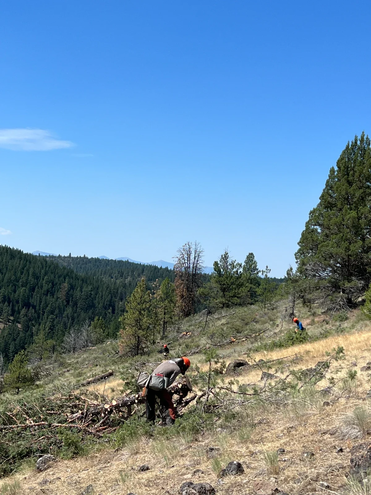
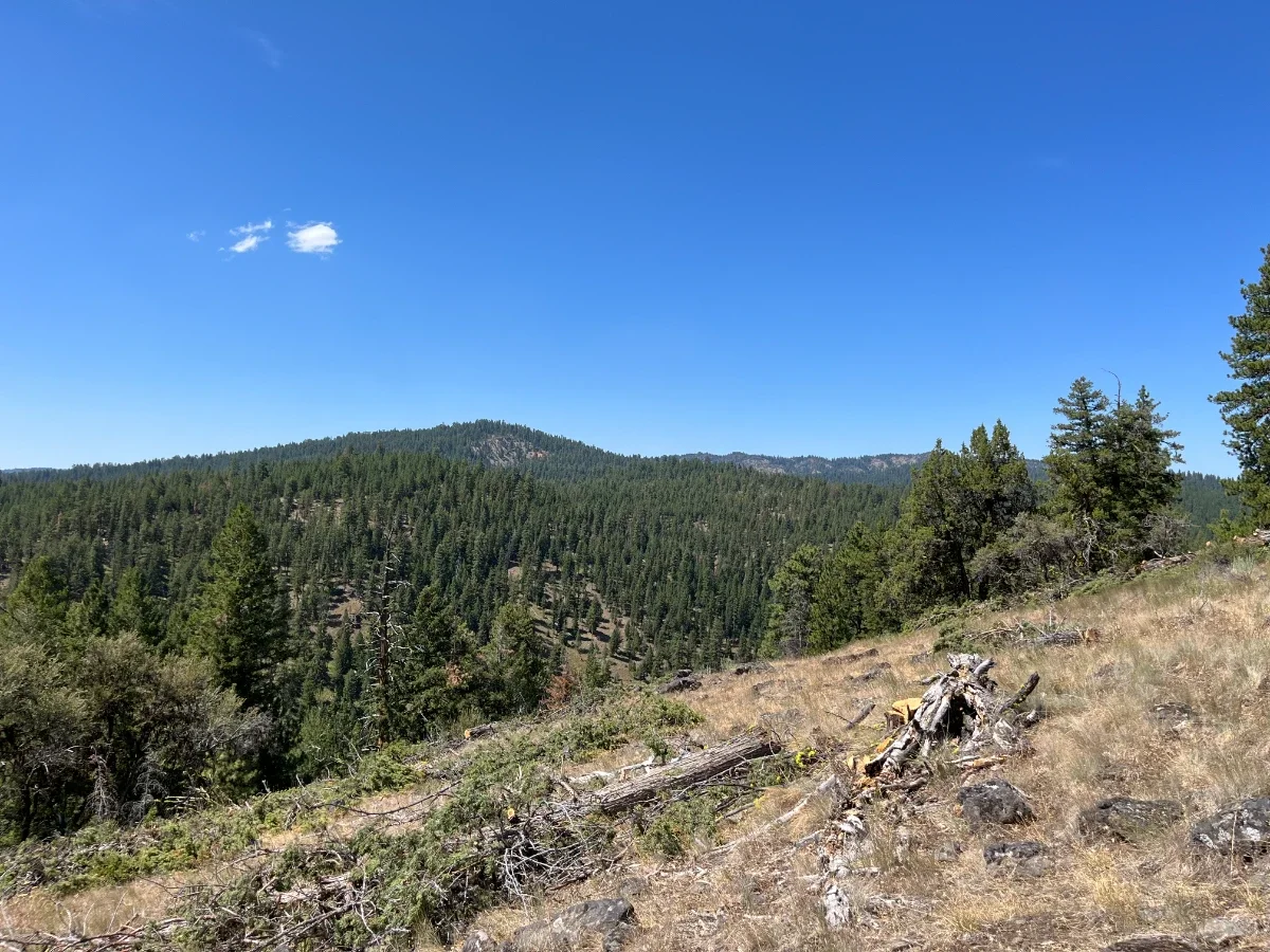
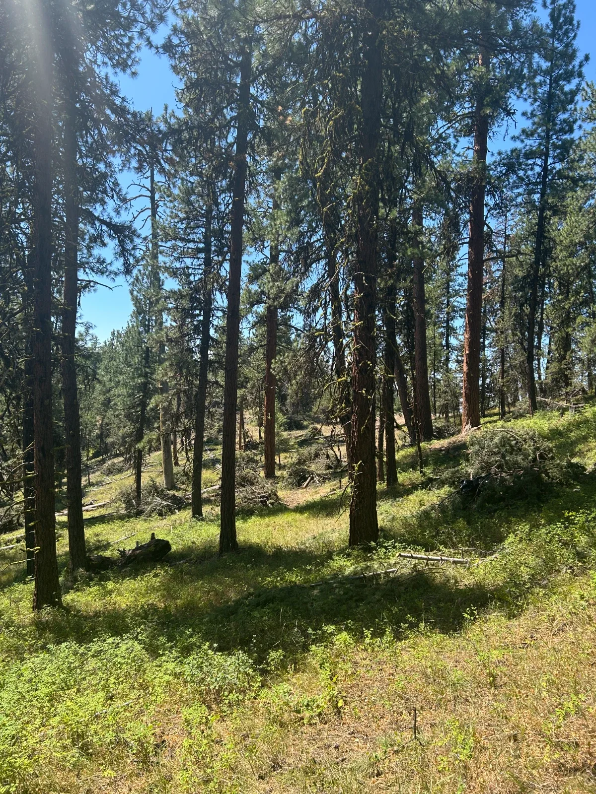
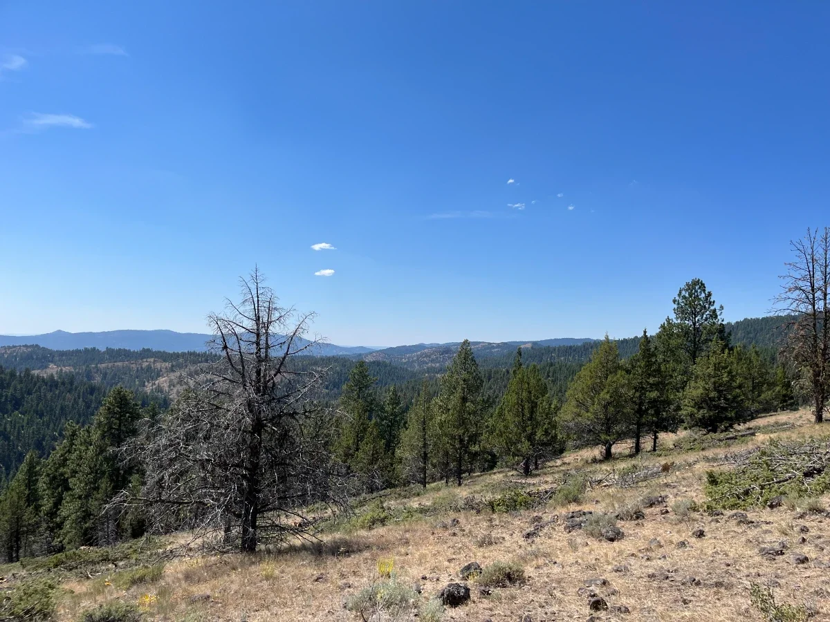
The Magone Project is on the Blue Mountain Ranger District within the Malheur National Forest and encompasses approximately 27,000 acres within two subwatersheds that drain into the Upper John Day River.
One of the objectives of the Magone project was to maintain or improve wildlife habitat. Approximately 740 acres in the Nipple Butte Inventoried Roadless Area occurring along ridgetops, drainages, and scablands with higher densities of bitterbrush, mountain mahogany, and various bunchgrasses were identified as high-priority wildlife habitat. Thinning the competing conifers and junipers will help release quality browse species for several wildlife species. Because these habitats occur in a largely unroaded area with minimal motorized disturbances, the increase in forage quality and quantity will be highly beneficial to habitat enhancement and retaining big game on the Forest.
Commercial and non-commercial thinning associated with the Magone Project are in various stages of completion. However, the partnerships and financial investments from Blue Mountain Elk Initiative, Rocky Mountain Elk Foundation, Oregon Department of Fish and Wildlife, and Oregon Hunters Association have contributed to a targeted approach of wildlife habitat improvement within the roadless area.
Past Projects
Explore our database of past projects.
-
1990: Red Hill Winter Range Fertilization (1,373 acres)
1990: Bridge Creek Fence Project #1 (280 acres)
1990: Cummings / Ables / Park Ridge Prescribed Burns (2,600 acres)
1991: North Fork Prescribed Burn (755 acres)
1991: Gibbon Ridge Winter Range Fertilization (720 acres)
1992: Dry Beaver / Ladd Canyon Habitat Enhancement #1 (19,125 acres)
1992: Otis Mountain Juniper Treatment (500 acres)
1992: Tepee Butte Noxious Weed Treatment (2,100 acres)
1992: Lord Flat Prescribed Burn (250 acres)
1992: South Beulah Road Rehabilitation (800 acres)
1992: Sparta Butte Habitat Enhancement #1 (1,355 acres)
1992: Heppner Forage Seeding Project (1,500 acres)
1992: Bridge Creek Fence Project #2 (400 acres)
1992: Hatchery Ridge Prescribed Burn (800 acres)
1993: Whiting Springs Enhancement (150 acres)
1993: Crawford Creek Access Management and Road Rehabilitation (9,290 acres)
1993: Boothill Prescribed Burn (200 acres)
1993: Donaldson Ridge Access Management and Road Rehabilitation (8,110 acres)
1993: Malheur Browse Seed Collection (500 acres)
1993: Wallowa County Information Station
1993: Grande Ronde Seeding and Fertilization (700 acres)
1993: Sparta Butte Water Development (2,560 acres)
1993: North Ochoco Elk Study
1993: Elk Vulnerability Assessment
1993: Dry Beaver / Ladd Canyon Habitat Enhancement #2 (350 acres)
1993: Jim Creek Noxious Weed Treatment (60 acres)
1993: Blue Mountains Elk Calf Mortality Study - Year 1
1993: Blue Mountains Salting Project #1
1994: Indian Creek Underburn (950 acres)
1994: Slide Creek Road Rehabilitation and Access Management (2,100 acres)
1994: Round Top Access Management (6,500 acres)
1994: Bear / Congleton Prescribed Burn (1,300 acres)
1994: Dry Beaver / Ladd Canyon Habitat Enhancement #3 (600 acres)
1994: Middle Fork John Day River Access Management #1 ; Galena / Susanville Unit (11,600 acres)
1994: Middle Fork John Day River Prescribed Burn #1 ; Galena / Susanville Unit (1,200 acres)
1994: Miller Shingle Forage Enhancement #1 (1,000 acres)
1994: Blue Mountains Elk Calf Mortality Study - Year 2
-
1995: Maury Mountains Road Rehabilitation (3,000 acres)
1995: Newsome Creek Underburn (600 acres)
1995: Dry Beaver / Ladd Canyon Habitat Enhancement #4 (1,590 acres)
1995: Blue Mountains Elk Initiative Video
1995: East End Access Management (1,860 acres)
1995: Beulah / South Sumpter Elk Telemetry Study - Year 1
1995: Blue Mountains Salting Project #2
1995: Blue Mountains Salting Project #3
1995: Blue Mountains Elk Calf Mortality Study - Year 3
1996: Middle Fork John Day River Access Management #2 (10,100 acres)
1996: Middle Fork John Day River Prescribed Burn #2 ; Caribou Units (1,450 acres)
1996: Hampton Pipelines Water Project (3,520 acres)
1996: Dry Beaver / Ladd Canyon Habitat Enhancement #1 (75 acres)
1996: Middle Fork John Day River Access Management #3 ; Northside Unit (12,500 acres)
1996: North Fork Camp Creek Prescribed Burn (1,600 acres)
1996: Birth Date / Summer Nutrition and Elk Calf Survival - Year 2
1996: Aspen and Cottonwood in the Blue Mountains Workshop
1996: Sparta Butte Prescribed Burn (200 acres)
1996: Beulah / South Sumpter Elk Telemetry Study - Year 2
1996: Dry-Coyote Understory Burn (1,450 acres)
1996: Bear Creek Watershed Prescribed Burn #1 (1,850 acres)
1996: Miller Shingle Forage Enhancement #2 (1,200 acres)
1996: Pasture Prescribed Burn (1,000 acres)
1996: Abel's Ridge Prescribed Burn (332 acres)
1997: Beulah / South Sumpter Elk Telemetry Study - Year 3
1997: Jim Creek / Cache Creek Water Developments (6,400 acres)
1997: Grande Ronde Prescribed Burn (900 acres)
1997: Smokey / Johnnie Prescribed Burn #1 (1,500 acres)
1997: Prater / Cow Aspen and Shrubland Treatment (725 acres)
1997: Wallowa-Whitman National Forest 1997 Noxious Weed Treatment Program (395 acres)
1997: Susanville Underburn (1,300 acres)
1997: Tincup Underburn (1,607 acres)
1997: Summit Underburn (1,250 acres)
1997: Ungulate Management to Enhance Grazed Seasonal Rangeland
1997: Blue Mountains Elk Initiative Brochure
1997: Bridge Creek Interpretive Signage
1997: Dry Beaver / Ladd Canyon Brochure Reprint
1997: South Boundary Fertilization and Salting (500 acres)
1997: Spring Creek Winter Range Enhancement #1 (1,175 acres)
1997: Albee Meadows Prescribed Burn (750 acres)
1997: Spring Creek Winter Range Enhancement #2 (1,140 acres)
1997: Blue Mountains Elk Initiative Brochure
1998: Dry Beaver / Ladd Canyon Prescribed Burn (300 acres)
1998: Round Top Prescribed Burn #1 (3,020 acres)
1998: Smokey / Johnnie Prescribed Burn #2 (72 acres)
1998: South Finger Prescribed Burn (2,462 acres)
1998: Windfall / Geary Prescribed Burn (3,500 acres)
1998: Bear Creek Watershed Prescribed Burn #2 (890 acres)
1999: Rager Access Management #1 and Green Dot Sign Installation (2,150 acres)
1999: Bear Creek / Trout Creek Road Rehabilitation (4,000 acres)
1999: Mountain Creek Meadow Restoration (172 acres)
1999: TNT Prescribed Underburn (2,580 acres)
1999: Spring Creek Winter Range Enhancement #3 (300 acres)
1999: Bear Valley Aspen Enhancement #1 (35 acres)
1999: North Fork Malheur River Winter Range Enhancement
1999: Spion Prescribed Burn (5,015 acres)
1999: Dry Beaver / Ladd Canyon Brochure Revision
1999: Round Top Prescribed Burn #2 (2,700 acres)
1999: Meadow Prescribed Fire Vegetation Response Study - Year 1
1999: Moonshine Prescribed Burn (700 acres)
1999: Upper Tucannon River Prescribed Burn (2,800 acres)
-
2000: Prineville Meadows Restoration (600 acres)
2000: Summer Foraging Dynamics of Mule Deer, Elk and Cattle - Year 3
2000: Keating Noxious Weed Treatment #1 (380 acres)
2000: Sugarbowl Creek / Thompson Creek Aspen Restoration #1 (24 acres)
2000: Sugarloaf Mountain / Green Mountain Aspen Restoration (13 acres)
2000: Middle Tucannon River Yellow Starthistle Treatment (30 acres)
2001: Bear Valley Aspen Enhancement #3 (10 acres)
2001: Sugarbowl Creek / Thompson Creek Aspen Restoration #2 (28 acres)
2001: Keating Noxious Weed Treatment #3 (380 acres)
2001: Lower Grande Ronde Cooperative Noxious Weed Treatment - Oregon #1 (249 acres)
2001: Beeler Ridge Aspen Restoration (55 acres)
2001: Trout Creek Prescribed Burn (800 acres)
2001: Prairie City Aspen Restoration #2 (30 acres)
2001: Bear Valley Aspen Enhancement #2 (4 acres)
2001: Blue Mountains - Wallowa Mountain Zone Aspen Management #1 (574 acres)
2001: Keating Noxious Weed Treatment #2 (600 acres)
2001: Bracken Yellow Starthistle Treatment #2 (750 acres)
2001: Lower Grande Ronde Cooperative Noxious Weed Treatment - Washington #1 (1,106 acres)
2001: Mount Horrible Prescribed Burn (2,400 acres)
2002: Double Cabin Riparian Restoration and Access Management (680 acres)
2002: Rager Noxious Weed Treatment (21 acres)
2002: Prairie City Aspen Restoration #3 (60 acres)
2002: Wolf Watershed Prescribed Burn (6,260 acres)
2002: South Boundary Access Management (1,000 acres)
2002: Jarboe Meadow / Brock Meadow Restoration #1 (400 acres)
2002: Little Wall / Swale Creek Fence Replacement #1 (560 acres)
2002: North Fork John Day Noxious Weed Treatment #3
2002: Jarboe Meadow / Brock Meadow Restoration #2 (400 acres)
2002: Paulina Ranger District Hound's Tongue Treatment #1 (381 acres)
2002: Sugarbowl Creek / Thompson Creek Aspen Restoration #3 (50 acres)
2002: Lower Grande Ronde Cooperative Noxious Weed Treatment - Oregon #2 (150 acres)
2002: Blue Mountains - Wallowa Mountain Zone Aspen Management #2 (95 acres)
2002: Cougar Creek Prescribed Burn (1,200 acres)
2002: Dippy Beaver / Clearwater Habitat Enhancement (4,760 acres)
2002: Wallowa-Whitman National Forest 2000/2001 Noxious Weed Treatment Program (1,763 acres)
2002: Lower Grande Ronde Cooperative Noxious Weed Treatment - Washington #2 (1,250 acres)
2003: Indian Butte Aspen Restoration (12 acres)
2003: Shady Creek Aspen Restoration (15 acres)
2003: Meacham Creek Yellow Starthistle Treatment #4 (951 acres)
2003: Prairie City Aspen Restoration #4 (70 acres)
2003: Desolation Aspen Restoration (5 acres)
2003: North Fork John Day Noxious Weed Treatment #4 (3,430 acres)
2003: Prairie City Aspen Restoration #5 (70 acres)
2003: Little Wall / Swale Creek Fence Replacement #2 (210 acres)
2003: Maury Mountains Water Development Maintenance (5,120 acres)
2003: Paulina Ranger District Hound's Tongue Treatment #2 (383 acres)
2003: Lick Creek Prescribed Burn Block #1 (500 acres)
2003: Lick Creek Prescribed Burn Block #2 (500 acres)
2003: Lick Creek Prescribed Burn Block #3 (220 acres)
2004: Morsay Aspen Restoration #1 (10 acres)
2004: Matlock Aspen Restoration #1 (60 acres)
2004: South Boundary Prescribed Burn and Pinyon-Juniper Thin (2,000 acres)
2004: Sherwood Prescribed Burn and Juniper Treatment (1,362 acres)
2004: Blue Mountains Mountain Mahogany Restoration (250 acres)
2004: Jarboe Meadow / Brock Meadow Restoration #3 (38 acres)
2004: North Fork John Day Noxious Weed Treatment #5 (3,430 acres)
2004: Morsay Aspen Restoration #2 (7 acres)
2004: Keating Noxious Weed Treatment #6 (250 acres)
2004: Wallowa Mountains Access Management (420 acres)
2004: Blue Mountains - Wallowa Mountain Zone Aspen Management #3 (33 acres)
2004: Dry Beaver / Ladd Canyon Access Management #1
2004: Paulina Ranger District Hound's Tongue Treatment #3 (489 acres)
2004: Lick Creek Prescribed Burn Block #4 (910 acres)
-
2005: Matlock Aspen Restoration #2 (19 acres)
2005: Green Pelican / Spring Creek Prescribed Burns (4,000 acres)
2005: Spring Creek Winter Range Access Management
2005: Hells Canyon National Recreation Area Noxious Weed Treatment #1 (40 acres)
2005: Lower Grande Ronde Cooperative Noxious Weed Treatment - Oregon #2 (78 acres)
2005: Morsay Aspen Restoration #3 (35 acres)
2005: North Fork John Day Noxious Weed Treatment #6 (3,430 acres)
2005: Lick Creek Prescribed Burn Block #5 (569 acres)
2006: Paulina Ranger District Hound's Tongue Treatment #4 (425 acres)
2006: Dry Beaver / Ladd Canyon Access Management #2
2006: Paulina Ranger District Wildlife Guzzlers #2 (1,920 acres)
2006: Sunflower Prescribed Burn (1,000 acres)
2006: North Fork John Day Noxious Weed Treatment #7 (3,430 acres)
2006: Morsay Aspen Restoration #4 (20 acres)
2006: Big Creek Aspen Restoration (18 acres)
2006: Donnelly Prairie Aspen Restoration (981 acres)
2006: Elk Nutrition / Predation Studies in Northeast Oregon #2
2006: Blue Mountains Elk Initiative 15th Anniversary Brochure
2007: Red Hill Spring Water and Aspen Restoration (4 acres)
2007: Thompson Creek Aspen Restoration #3
2007: Bone Canyon / Indian Creek Aspen Restoration
2007: Catskull Aspen Restoration (26 acres)
2007: Deep Creek Thin and Noxious Weed Treatment #1 (832 acres)
2007: Sunflower Aspen Restoration (3 acres)
2007: Swain and Boone Prairie and Aspen Restoration (1,260 acres)
2007: Westgate Canyon / South Canyon Fence Construction #2 (5,000 acres)
2007: Winom-Frazier / Mt. Emily Access Management (23 acres)
2007: Blue Mountains Elk Habitat Model Update - Washington
2007: Lick Creek Prescribed Burn Block #6 (1,000 acres)
2007: Charley Creek Prescribed Burn (1,345 acres)
2008: Anderson Creek Aspen Restoration (11 acres)
2008: North Fork John Day Noxious Weed Treatment #8 (3,430 acres)
2008: Wheeler County Aspen Restoration (12 acres)
2008: Glass Hill Habitat Enhancement (310 acres)
2008: Deep Creek Thin and Noxious Weed Treatment #2 (888 acres)
2008: Glass Hill Noxious Weed Treatment #2 (151 acres)
2008: Cook Field Forage Pasture (30 acres)
2009: Elder Flat Noxious Weed Treatment (481 acres)
2009: 16 Road Prescribed Burn and Fence (433 acres)
2009: Antelope 2 Prescribed Burn (2,441 acres)
2009: Foothill Winter Range Enhancement (734 acres)
2009: Little Emigrant Habitat Enhancement (1,078 acres)
2009: North Fork John Day Noxious Weed Treatment #9 (3,500 acres)
2009: Hells Canyon Rush Skeletonweed Noxious Weed Treatment (3,250 acres)
2009: Deep Creek Thin and Noxious Weed Treatment #3 - Phase II (4,669 acres)
2009: Murderer's Creek Juniper Removal #1 (115 acres)
2009: Mid Maury Mountain Winter Range Enhancement - Thin and Prescribed Burn (247 acres)
2009: Owsley Canyon Forage Enhancement (840 acres)
2009: Wallowa Canyonlands Partnership Noxious Weed Treatment #2 (638 acres)
2009: Grouse Flats Forage Pasture (255 acres)
-
2010: Egley Wildfire Rehabilitation #1 (5,505 acres)
2010: Gulliford Prescribed Burn (488 acres)
2010: Hells Canyon Wilderness Homesteads Noxious Weed Treatment (90 acres)
2010: North Fork John Day Noxious Weed Treatment #10 (3,400 acres)
2010: Potamus Prescribed Burn (265 acres)
2010: Upper Malheur Habitat Restoration (350 acres)
2010: Deep Creek Thin and Noxious Weed Treatment #4 (1,333 acres)
2010: Farris Pine Creek Riparian Restoration (2,150 acres)
2010: Murderer's Creek Juniper Removal #2 (1,092 acres)
2010: Chrome Ridge Seeding (910 acres)
2011: Dow Ranches Habitat Enhancement (168 acres)
2011: Egley Wildfire Rehabilitation #2 (475 acres)
2011: Logan Valley Meadow and Aspen Restoration (44 acres)
2011: Mid Maury Mountain Winter Range Enhancement - (264 acres)
2011: Wallowa Canyonlands Partnership Noxious Weed Treatment #3 (1,609 acres)
2011: Willow Pine Habitat Enhancement #1 (396 acres)
2011: Chicken Hill Thin #1 (180 acres)
2011: Hardscrabble Ridge Thin and Noxious Weed Treatment (126 acres)
2011: Wallowa Canyonlands Partnership Noxious Weed Treatment #4 (1,340 acres)
2011: North Fork John Day Noxious Weed Treatment #11 (2,000 acres)
2011: Willow Pine Habitat Enhancement #2 (263 acres)
2011: Dry Fork Prescribed Burn (1,000 acres)
2011: Robinette Mountain Noxious Weed Treatment (1,400 acres)
2012: East Maury Juniper Thin and Prescribed Burn (97 acres)
2012: Knox Aspen and Meadow Restoration (12 acres)
2012: Monument Winter Range Weed Treatment (600 acres)
2012: Bridge Creek Headwaters Noxious Weed Treatment (367 acres)
2012: Chicken Hill Thin #2 (213 acres)
2012: Dairy Creek Water and Access Management (4,195 acres)
2012: Starvout Ridge Noxious Weed Treatment (1,000 acres)
2013: East Maury Juniper Thin and Seed (400 acres)
2013: Wallowa Canyonlands Partnership Noxious Weed Treatment #5 (120 acres)
2013: North Fork John Day Noxious Weed Treatment #12 (2,000 acres)
2013: Wapiti Ranch Winter Range Enhancement
2013: West Blue Mountains Winter Range Seeding (1,030 acres)
2013: Chicken Hill Thin #3 (248 acres)
2014: Chesnimnus Wildlife Management Unit Prescribed Burn (365 acres)
2014: Chesnimnus Wildlife Management Unit Prescribed Burn (1,084 acres)
2014: Maury Wildlife Habitat Improvement
2014: Wallowa Canyonlands Partnership Noxious Weed Treatment #6
2014: Twin Lakes Timber Stand Improvement (72 acres)
-
2015: Chicken Hill Thin #4 (466 acres)
2015: Marks Canyon Aspen Enhancement
2015: Ladd Canyon Thinning for Elk Enhancement 2015 (400 acres)
2015: Horseshoe Prairie Road Closures (2,700 acres)
2015: Chesnimnus Elk Burn (250 acres)
2015: Upper Beaver Wildlife Habitat Improvement Project 2015 - Phase 2 (1,217 acres)
2015: Twin Lakes TSI (Timber Stand Improvement) for Elk Habitat Enhancement (100 acres)
2015: Chase Mountain Road Closures (2,700 acres)
2015: Wenaha Invasive Plant Management (150 acres)
2015: Desolation Creek Habitat Enhancement (450 acres)
2015: Glass Hill Elk Habitat Enhancement (948 acres)
2016: Elk Security and Habitat Enhancement - OCH (2,400 acres)
2016: McKay Creek Watershed Wildlife Habitat Enhancement Project - OCH (600 acres)
2016: Ladd Canyon Thinning for Elk Enhancement 2016 - WAW (372 acres)
2016: Central Malheur River & Egley Burn Transition Range Enhancement - MAL (7,700 acres)
2016: Desolation Creek, LLC Habitat Enhancement Phase Ii - NFJDWC (758 acres)
2016: Upper Stage Gulch Habitat Improvement - CTUIR (70 acres)
2016: Desolation Winter Range Prescribed Burn - UMA (1,330 acres)
2016: Dark Canyon Prescribed Fire - UMA (1,750 acres)
2016: Sled Springs Elk Security and Forage Enhancement - WAW (250 acres)
2017: Old Dry Creek Juniper Treatment and Spring Protection (1,000 acres)
2017: Gap Wildlife Habitat Enhancement Project (852 acres)
2017: South Starkey Thinning for Elk Enhancement 2017 (820 acres)
2017: Chesnimnus Elk Burn (500 acres)
2017: Sunflower-Monument Winter Range Habitat Enhancement (3,000 acres)
2017: Damon Aspen Enhancement Hingewood Thinning (240 acres)
2017: Control of Medusahead along the Grande Ronde River in Asotin County, WA (580 acres)
2017: Popple Aspen Restoration Project (92 acres)
2017: Union County Yellow Starthistle Control (1,406 acres)
2018: Jackson Wildlife Habitat Enhancement Project (240 acres)
2018: South Starkey Thinning for Elk Enhancement (612 acres)
2018: North and South Finger Road Closures
2018: McKay Creek Wildlife Habitat Improvement (945 acres)
2018: John Day Headwaters Access Management Project
2018: Spring Creek Winter Range Enhancement (2 acres)
2018: Thorn JuniperConifer Treatment and Spring Protection (800 acres)
2019: DDD (Dairy, Dry Mountain, Donnelly) Water & Elk Security Improvements (3,280 acres)
2019: South Starkey Thinning for Elk Enhancement (600 acres)
2019: North Grizzly Wildlife Habitat Improvement Project (45 acres)
2019: Chesnimnus Elk Burn #5 (500 acres)
2019: Southern Blue Mnt Elk Distribution Project
2019: Gap Prescribed Burn (455 acres)
2019: Blue Mnt Elk model validation
-
2020: OCH Greater Williams Prairie (2,713 acres)
2020: OCH Old Dry Creek Rx Burn (1,000 acres)
2020: WW Syrup Creek (250 acres)
2020: Union County Yellow Starthistle Part #4 (2,000 acres)
2020: TriCounty CWMA Owsley Canyon Invasive Grass (270 acres)
2020: Asotin Co Cougar Creek (700 acres)
2020: ODFW Ochoco Elk Collaring
2020: Gate, signs, brochures, youth event
2021: WW South Starkey Thinning (1,000 acres)
2021: OCH Son Stewardship - Aspen and Meadow Enh (61 acres)
2021: OSU-Starkey Syrup Creek Forage Research
2021: ODFW PhillipWSchneider Range Restoration (1,000 acres)
2021: UMA OR Prescribed Burns (6,000 acres)
2021: Morrow SWCD Blue Mountain Fence Phase IV
2022: OCH Greater Williams Prairie (1,181 acres)
2022: WWW South Starkey Thinning (1,000 acres)
2022: MAL Summit Project Aspen/Meadows (125 acres)
2022: Union County Yellow Starthistle (4,000 acres)
2022: TriCounty CWMA Owsley Canyon Invasive Grass Phase II (250 acres)
2023: Blue Mountain Wildlife Areas Noxious Weed Control 2023 (1,142 acres)
2023: Sunflower Winter Range Enhacement (187 acres)
2023: Minam River Broadleaf Noxious Weed Control (75 acres)
2023: Smiley Ridge Prescribed Fire and Noxius Weed Treatment
2023: Union County Star Thistle (4,500 acres)
2023: Blue Mountain Wildlife Fence Modificiation Phase V (85,000 acres)
2023: Asotin Creek WLA Grass Re-seeding (655 acres)
2023: Limber Jim Thinning for Elk Enhancement (1,116 acres)
2024: ODFW - Ukiah Travel Management (4,500 acres)
2024: Ochoco - Sunflower Juniper (150 acres)
2024: Malheur - Damon Aspen (300 acres)
2024: Malheur - Magone Juniper (660 acres)
2024: Wallowa Whitman - Sheep Creek Thinning (1,062 acres)
2024: ODFW - Ochoco Elk Collaring
2024: Minam River Broadleaf Control 2024 (25 acres)
2024: ODFW - PWSWA Forage Enhancement (646 acres)
2024: WDFW - Wooten Wildlife Area Noxius Weed (300 acres)
2024: Morrow SWCD - Wildlife Friendly Fence (85,000 acres)
2024: Wallowa Resources - Lower Imnaha Herbicide (25 acres)
2024: Union County Star Thistle (2,500 acres)
-
2025: Ochoco - GWP Phase II (294 acres)
2025: ODFW - Bridge Creek WMA (512 acres)
2025: Ochoco - Indian Prairie (51 acres)
2025: Tri-County - CWMA - Minam River Broadleaf (325 acres)
2025: WDFW - Wooten Weed Control (300 acres)
2025: Union County - Yellowstarthistle (2,500 acres)
2025: WDFW - 4O Ranch Wildlife Area (750 acres)
2025: Baker CWD - Alder-Ebell Creek (100 acres)
2026: MAL:- Magone Juniper Thinning (740 acres)
2026: Tri-County CWMA - Minam River Broadleaf Noxious Weed Control 2026 (25 acres)
2026: UMA - Smiley Ridge Prescribed Fire and Noxious Weed Treatment Project (1,341 acres)
2026: Union County Yellow Starthistle Control 2026 (2,500 acres)
2026: WDFW - WT Wooten Wildlife Area Noxious Weed Control 2026
2026: W-W North Fork Burnt River Watershed Habitat Enhancement - 2025 (1,304 acres)